I hope someone can help, because despite extensive searching and trial and error I am getting nowhere...
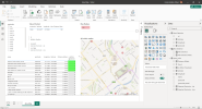
My aim is to select a postcode area (eg. BS10, L20, LS9) and radius in miles, and the map visual will show all staff within that radius around the chosen postcode area.
I have two tables of data - rv_staff - this shows all staff members and their addresses, including postcodes (both full and partial) as well as the coordinates of said postcode Area Selection - this is a list of all UK postcode areas (so first half only) and the corresponding coordinates, along with area (Leeds/Manchester/Bristol etc) and other details.
These tables have a many-to-one relationship from the staff table to the area selection table on the partial postcodes (as there are more than one postcode on the staff table, and only one on the area table).
I have a radius slider set up, and I want a slicer/drop-down list to be able to choose a partial postcode from the Area Selection table. This should then populate a table of all staff and the distance from the selected postcode to each staff member (within the specified radius as selected).
Here is where I struggle though. My distance haversine formula just does not work and I don't know why, as I haven't changed anything other than the lat/long references.
The initial code I tried as per several sites/people:
With this formula (radius set to 100) it shows that people who live in Cornwall/Devon are between 50-100 miles from anywhere, even Glasgow.
So I set up two measures to retrieve the lat and long from the selected postcode area for checking purposes:
I have these in a table and every time I select a new postcode area, the coordinates change accordingly. Some spot checking on google maps shows the coordinates are correct for the location, so I know there's no issues with the initial postcode selection.
So I tried adding these into the haversine formula to see if this would work (I don't know why it needs to be a min() value if you're using just one set of coordinates here - maybe someone can enlighten me):
This (probably expectedly) shows zero for everything.
I also tried a column approach as suggested

 community.fabric.microsoft.com
, but this just errors (An argument of function 'ACOS' has the wrong data type or the result is too large or too small).
community.fabric.microsoft.com
, but this just errors (An argument of function 'ACOS' has the wrong data type or the result is too large or too small).
I just don't know what else to try or why I'm not getting the correct results... I have a test file which has the exact same issues, but as it's a .pbix I cannot upload it. I've double checked to ensure nothing is summarised (some were, so I've fixed that) and the Min values look to be correct. Any postcode that falls within the selected partial postcode looks to be working (so if NW1 is selected, all postcodes starting NW1 are showing correct miles, but no other postcodes show - anything that is not NW1 is showing a distance of 1780.25 miles.
Any help or suggestions would be most appreciated!
My aim is to select a postcode area (eg. BS10, L20, LS9) and radius in miles, and the map visual will show all staff within that radius around the chosen postcode area.
I have two tables of data - rv_staff - this shows all staff members and their addresses, including postcodes (both full and partial) as well as the coordinates of said postcode Area Selection - this is a list of all UK postcode areas (so first half only) and the corresponding coordinates, along with area (Leeds/Manchester/Bristol etc) and other details.
These tables have a many-to-one relationship from the staff table to the area selection table on the partial postcodes (as there are more than one postcode on the staff table, and only one on the area table).
I have a radius slider set up, and I want a slicer/drop-down list to be able to choose a partial postcode from the Area Selection table. This should then populate a table of all staff and the distance from the selected postcode to each staff member (within the specified radius as selected).
Here is where I struggle though. My distance haversine formula just does not work and I don't know why, as I haven't changed anything other than the lat/long references.
The initial code I tried as per several sites/people:
Code:
Distance =

var Lat1 = MIN('Area Selection'[latitude])
var Lng1 = MIN('Area Selection'[longitude])

var Lat2 = MIN(rv_staff[Lat])
var Lng2 = MIN(rv_staff[Long])

var P = DIVIDE( PI(), 180)
var A = 0.5 - COS((Lat2-Lat1) * p)/2 +
    cos(Lat1 * p) * COS(Lat2 * P) * (1-COS((Lng2 - Lng1) * p)) /2
var final = (3958 * ASIN((SQRT(A))))
return final
With this formula (radius set to 100) it shows that people who live in Cornwall/Devon are between 50-100 miles from anywhere, even Glasgow.
So I set up two measures to retrieve the lat and long from the selected postcode area for checking purposes:
Code:
Selected Postcode - Lat = LOOKUPVALUE('Area Selection'[latitude], 'Area Selection'[postcode], SELECTEDVALUE('Area Selection'[postcode]))
Code:
Selected Postcode - Long = LOOKUPVALUE('Area Selection'[longitude], 'Area Selection'[postcode], SELECTEDVALUE('Area Selection'[postcode]))I have these in a table and every time I select a new postcode area, the coordinates change accordingly. Some spot checking on google maps shows the coordinates are correct for the location, so I know there's no issues with the initial postcode selection.
So I tried adding these into the haversine formula to see if this would work (I don't know why it needs to be a min() value if you're using just one set of coordinates here - maybe someone can enlighten me):
Code:
Linguist Distance (Miles) =

var Lat1 = [Selected Postcode - Lat]
var Lng1 = [Selected Postcode - Long]

var Lat2 = MIN(rv_staff[Lat])
var Lng2 = MIN(rv_staff[Long])

var P = DIVIDE( PI(), 180)
var A = 0.5 - COS((Lat2-Lat1) * p)/2 +
    cos(Lat1 * p) * COS(Lat2 * P) * (1-COS((Lng2 - Lng1) * p)) /2
var final = (3958 * ASIN((SQRT(A))))
return final
This (probably expectedly) shows zero for everything.
I also tried a column approach as suggested
Distance Calculation in Power BI
Hey, I wanted to know that once I have plotted several locations on a map in Power BI, how can I calculate the distance between any two locations?
Code:
Distance = acos(sin([Selected Postcode - Lat])*sin(rv_staff[Lat])+cos([Selected Postcode - Lat])*cos(rv_staff[Lat])*cos(rv_staff[Long]-[Selected Postcode - Long]))*3958I just don't know what else to try or why I'm not getting the correct results... I have a test file which has the exact same issues, but as it's a .pbix I cannot upload it. I've double checked to ensure nothing is summarised (some were, so I've fixed that) and the Min values look to be correct. Any postcode that falls within the selected partial postcode looks to be working (so if NW1 is selected, all postcodes starting NW1 are showing correct miles, but no other postcodes show - anything that is not NW1 is showing a distance of 1780.25 miles.
Any help or suggestions would be most appreciated!
Last edited by a moderator:
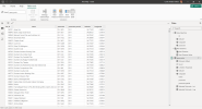
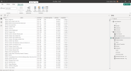
 Not sure what else I can do to reduce it enough. Have added screenshots of my tester file in the hopes that helps more in the meantime.